The Heysen Trail; Australia's longest marked footpath at around 1100 kilometres of rough desert, dirty sheep paddocks, country roads and outback towns and a banger of a Southern coastline.
It's hilly, it's dry, it's peppered with huts and fantastic lookouts and for now, right now; you can have the whole righteous ramble to yourself.
The popularity of the often crowded Bibbulmun Track (Australia's other 1000 kilometre walk in Western Australia) hasn't transferred over to the Heysen and hopefully it stays that way.
I hiked the Heysen Southbound over 40 days in June/ July 2022 with a couple of zero days in Quorn and Victor Harbor, respectively.
.png) |
| Map sourced from Google Maps. |
.png) |
| Map sourced from Friends of the Heysen Trail. |
Getting to and from the Trailheads:
North- I pre booked the once weekly Genesis shuttle from Adelaide central bus station that departs 7:30am on Thursday's.
It's a smallish vehicle that contained 3 of us would be end to end Heysen hikers (only one hardy legend made it to Cape Jervis which gives you an idea of the strike rate) and a variety of other passengers jumping off at various dusty towns on the way.
The bus spits you out at the Parachilna turnoff and the last 17 kilometres is a choose your own adventure between thrifty road walking for a few hours or paying a boofy bloke in a boofy 4WD blasting Beyonce shizz a fist full of dollars for a speedy drop off.
We reached the Parachilna trailhead around 1:30pm via boofy guy in boofy 4WD.
The return journey back to Adelaide from Parachilna for Northbound hikers runs on Friday's.
South- The Sealink bus makes a daily run to Cape Jervis departing from the Adelaide central bus station at 3:30pm, arriving at the Southern trailhead around 5:15pm, $27.
I caught the daily Cape Jervis up to Adelaide shuttle with Sealink ($27) departing 9:30am, arriving Adelaide 11:25am.
Resupply and Trail Towns:The second best thing about the Heysen is the crazy little outback towns the trail pokes through on it's wiggly route.
I carried 3 or 4 days food at a time and stocked up at:
- Wilpena- Good IGA supermarket. Butane gas cannisters.
- Quorn- Small supermarket and great hiker hostel; Elizabeth House. Gas.
- Melrose- Adequate general store and spacious, cheap camping/ caravan park. Gas.
- Crystal Brook- Good supermarket, pharmacy. Gas.
- Spalding- Adequate general store. Gas.
- Burra- Good supermarket and town with full facilities. Gas.
- Kapunda- Large supermarket and my favourite trail town. I stayed overnight on a whim and had a blast. Gas.
- Tanunda- Large supermarket, full on tourist town.
- Bridgewater- Coles supermarket.
- Mt Compass- Good supermarket.
- Heysen's Rest Hiker Cabins. Great overnight stop between Mt Compass and Robinson's Hill campsite. Definitely go the full breakfast next morning. No resupply.
- Inman's Valley General Store- No resupply but 100% recommend grabbing a feed off the menu if the kitchen is kicking. Cafe.
- Victor Harbor- Largest town near the Heysen (7 kilometres off trail), Coles and Woolworths. Gas.
All towns have somewhere to procure water and food to go. There is usually a pub room and/or campsite to crash in too.
Dining is generally restricted to simple Aussie pubs with a generic menu and general stores flipping a toasted sandwich at you but the larger tourist towns such as Tanunda and Victor Harbor contain many fast food options and a higher standard of accommodation if that floats your boat.
Water is scarce on the trail.
I completely relied on the tanks situated in the walker campsites. Camel up and fill the bottles when you can. I never filtered any water and never got sick. Your call, you do you.
Navigation and Resources:I gave up my curmudgeon ways and downloaded the Far Out Heysen Trail mapping file, shunned all paper maps and kept a sharp eye out for oft sighted Heysen marker posts as I bumbled along fencelines and dry creek beds.
The Friends of the Heysen are a bunch of super cool walking heroes that maintain and protect and improve the trail. Kudos you badasses!
The website is here.
Strongly consider throwing them a donation after walking on the Heysen.
Camping:
Most nights were spent plonked out in a super quiet spot either stealth camping in the bush wherever I pleased or in the official hiker walk in sites. These official sites are often located on private land and consist of a bench and water tank and flat ground to throw up the tent, like the photo below of Eyre Depot.
There are loads of huts and shelters as well. I avoided these like herpes as most hikers seem to gravitate to a roof and walls when it's available and I value my solitude.
I dunno, I spend enough nights indoors so when I am finally out hiking in the woods the nylon walls of my tent and the stars twinkling above seem like bliss. But the backcountry huts are there if you get excited about mice running over your face in the middle of the night or drunk bogans playing bush warriors on a Saturday evening.
All hut hate aside, I'm the first to admit they are great for holing up or taking a break when the weather is hooting down.
Weather and Landscape:
Most of the Heysen Trail is closed during the Summer months due to bushfire risk, particularly where it wends over private land.
I hiked it in the Winter and lucked out with mostly fine, settled weather. Temps slid down to single digits in the early morning and up to early teens mid afternoon.
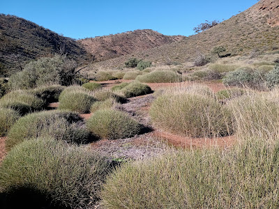
The Northern area around the Flinder's Ranges National Park features alpine desert forest, spiky spinifex, rocky bluffs and many kilometers trudging in dry creek beds.
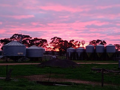
After descending Mt Remarkable and rolling through Melrose it's green farm country with a few small conservation parks dotted about.
I witnessed loads of slippery lambs being born and the sound of baaing sheep was the soundtrack to my walk.
South of Adelaide you are charging towards the coast and beautiful sheer cliffs and sandy beaches.
There's much variation in landscape and plenty of surprises. If you don't mind a bit of quiet road walking and straddling 2000 odd fence stiles then a Winter walk of this path through South Australia is a solid choice.
Thoughts:
I was never bored on this hike. Never wanted to be somewhere else. Didn't really want it to end either. I slowed right down in the South and dragged out the last 200 kilometres as long as I could.
Positives:
- It's unpopular but that's changing, evolving. You get solitude but increasing trail services and friendly locals that kind of know what your doing.
- Empty campsites and great intel via the Far Out app.
- Well marked trail, easy resupply.
- Mobile coverage is good. If you want that.
Not so positive:
- I heard the occasional bit of gunfire on this walk, as you do. One Saturday night while attempting to stealth camp outside Wilmington a drunk bogan in a 4WD skidded to stop near my tent and proceeded to blast away into the bush, probably random Roo shooting. I froze and hoped for the best and listened to him swear and stomp around and completely miss seeing me and after Mr Trigger-happy Fuckface departed in a hail of gravel I packed up quick smart and bailed into Wilmington, camping on the Golf Course. There are a couple of reports floating around of wild Friday and Saturday nights around Wilmington involving firearms experienced by bewildered hikers.
- The trail is quite exposed. Not many bug out spots aside from the trail towns and no shelter other than the huts.
- If you are chasing a wild landscape with dreamy mountain vistas and alpine lakes then the mundane agricultural land in the middle of the Heysen may disappoint. I just loved being out there but that's me.
Would I hike the Heysen again? Fuck yes.
Any questions, give me a hoy. safarihiker@gmail.com
.png)
.png)


